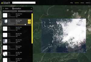
As I was trying to figure out snow levels on access roads, I came across this super handy tool:
https://soar.earth/maps
You can use it to find free satellite images from the last few days anywhere on the planet. I'm still not an expert at all the options, but it saved me a significant amount of extra walking as I learned my Plan A route had snow much lower down the road than I would have guessed.
Here's what it showed for my plan B. The actual snow line was almost exactly where the image indicated
Some area seem to be blocked by clouds more often than not, so you may not be able to see exactly what you're looking for
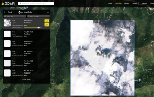
This also seems handy for gauging general snow coverage early and late season. Hopefully someone finds it useful!
https://soar.earth/maps
You can use it to find free satellite images from the last few days anywhere on the planet. I'm still not an expert at all the options, but it saved me a significant amount of extra walking as I learned my Plan A route had snow much lower down the road than I would have guessed.
Here's what it showed for my plan B. The actual snow line was almost exactly where the image indicated
Some area seem to be blocked by clouds more often than not, so you may not be able to see exactly what you're looking for
This also seems handy for gauging general snow coverage early and late season. Hopefully someone finds it useful!
")