PowderPanda
Staff member
North Idaho Avy center is not giving forecasts any longer, but to note some things I have observed. Last week the mtn's received in excess of 12"+. This set on the crust layer that had formed. Last Sat while riding at Silver with Mike, we both set off pretty significant wet slides of new storm snow that released on that layer. Both releases were on NE aspects that probably got some cross loading from that weird East and South wind we had during that storm cycle.
This last week we had pretty cold temps at night in the high alpine that hopefully bonded these layers. A quick test of the top 2 ft would be prudent if any steep terrain.
This weekend will be interesting with some new snow above 5200ft level after Saturday.. that could last through the first part of next week. Could see 4-7" above 5200ft level. Winds mainly out of the West.. then SW by Sunday morning when the temps cool. NE slopes could see some loading...
I'm shooting at hitting some bc next weekend... I have a chute that I have been eyeing all winter!
Cheers
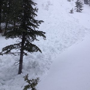
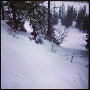
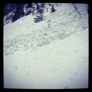
Pix below: Entrance into chute and then the aftermath. Those chunks were very large.
This last week we had pretty cold temps at night in the high alpine that hopefully bonded these layers. A quick test of the top 2 ft would be prudent if any steep terrain.
This weekend will be interesting with some new snow above 5200ft level after Saturday.. that could last through the first part of next week. Could see 4-7" above 5200ft level. Winds mainly out of the West.. then SW by Sunday morning when the temps cool. NE slopes could see some loading...
I'm shooting at hitting some bc next weekend... I have a chute that I have been eyeing all winter!
Cheers
Pix below: Entrance into chute and then the aftermath. Those chunks were very large.
Attachments
-
 1.3 MB Views: 3
 -
 1 MB Views: 3